Salar and Altiplano followed by climbing of Guallatiri
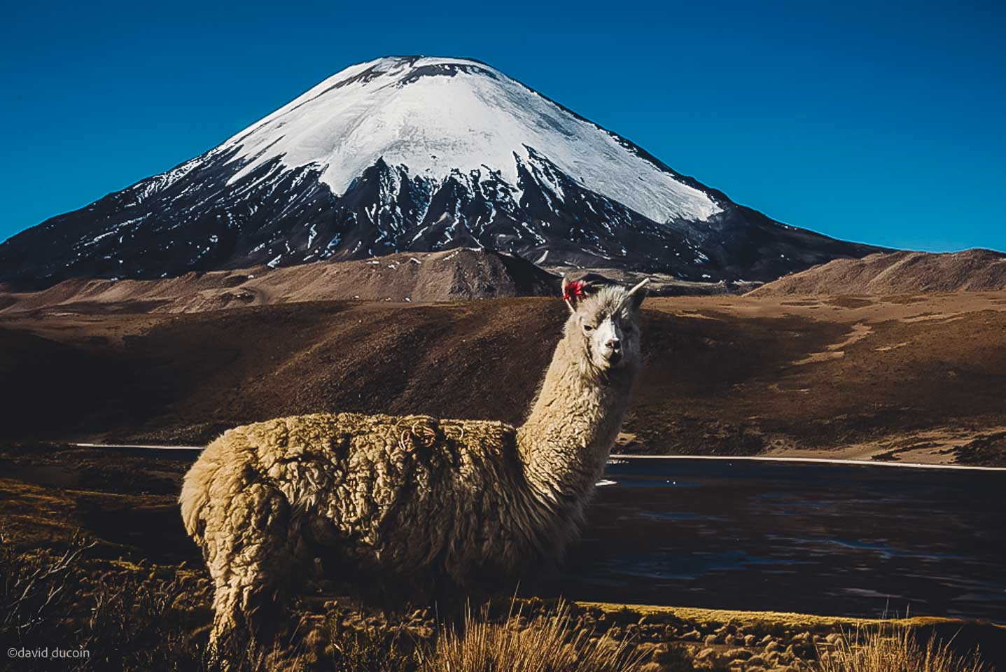
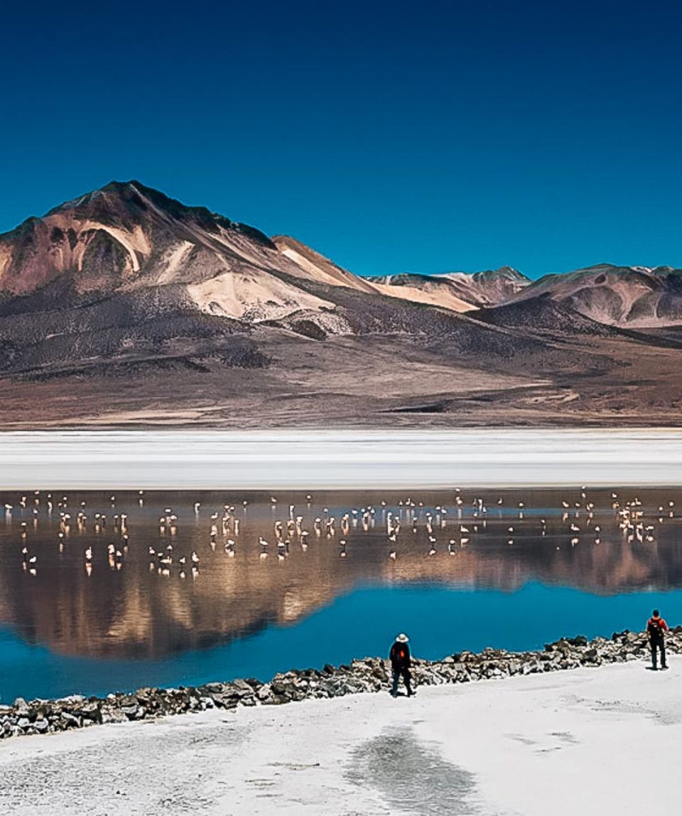
fromDiscover the largely unexplored trekking peak in Salar and Altiplano. It is 16 days of hiking on the Chilean altiplano where we discover an unknown region. In this region, you will see Aymara villages and the border market. This trip also gives you scenic views of volcanoes, peat bogs, lava fields, Inca trails, altiplano, flamingos, llamas, alpacas, vicuñas and many other animal species! From Arica, we leave for a hike that will take us to altiplano. We move in the national reserve of vicuñas then we ascend a “small” summit near Salar de Surire. On this trip, we also get to spend six nights in hostels run by Aymara families. After a cosy stay at the hostels, we climb Cerro Chihuana and Guallatiri, two non-technical high altitude peaks which treat you with bird-eye views of the landscapes below.
Discover Salar and Altiplano like never before and join us on this never to forget trip!
- Reviews 0 Reviews0/5
- Vacation Style Holiday Type
- Chile
- Mountainous
- Secret Planet
- Trekking
-
- Activity Level Moderate
- Group Size Medium Group
Discover the largely unexplored trekking peak in Salar and Altiplano. It is 16 days of hiking on the Chilean altiplano where we discover an unknown region. In this region, you will discover the Aymara villages and the border market. This trip also gives you scenic views of volcanoes, peat bogs, lava fields, Inca trails, altiplano, flamingos, llamas, alpacas, vicuñas and many other animal species! From Arica, we leave for a hike that will take us to altiplano. We move in the national reserve of vicuñas then we ascend a “small” summit near Salar de Surire. On this trip, we also get to spend six nights in hostels run by Aymara families. After a cosy stay at the hostels, we climb Cerro Chihuana and Guallatiri, two non-technical high altitude peaks which treat you with bird-eye views of the landscapes below.
Highlights of this trek exploring Salar and Altiplano are;
- A relatively hidden and largely unexplored region of Chile
- The climb of an active volcano at 6060 m
- Wildlife and exceptional birdlife
- 6 nights in hostels run by Aymara families
- Chile travel adviceby GOV.UK on 27/01/2026 at 12:51 pm
Removal of information about the Jama Pass Border closure and an updated assessment that terrorists are likely to try to carry out attacks in Chile (‘Safety and security’ page).
- Day 1 and 2 EUROPE - ARICA
- Day 3 ARICA - COPAQUILLA
- Day 4 COPAQUILLA - CAILLAMA
- Day 5 CAILLAMA - BELEN
- Day 6 BELEN - ALTOS MISAÑA
- Day 7 CHALLAPACHETA - CHUBA - LAUCA
- Day 9 LAUCA - SALAR DE SURIRE
- Day 10 SALAR DE SURIRE - ASCENSION OF CERRO CHIHUANA (5300 M)
- Day 11 SURIRE - LAKE CHUNGARA - SOUTH CAMP OF PARINACOTA
- Day 12 WILDLIFE TRAIL
- Day 13 SOUTH CAMP OF PARINACOTA - LAGUNA OF COTACOTANI - PARINACOTA
- Day 14 PARINACOTA - SURIPLAZA - CERRO IQUILLA (5,300 M)
- Day 15 SURIPLAZA - CAQUENA TOURNAMENT - PARINACOTA
- Day 16 PARINACOTA - GUALLATIRI BASE CAMP 5 100 M
- Day 17 GUALLATIRI BASE CAMP - GUALLATIRI SUMMIT 6 060 M - PUTRE
- Day 18 PUTRE - JURASI - ARICA
- Day 19 SMALL HIKING ALONG THE FALESES OF ARICA
- Day 20 EUROPE Departure
- Day 21 ARRIVAL IN EUROPE
ACCOMMODATION
In a good standard hotel (base: double room) in Arica, tent or inn during the trek.
MEAL
When in the cities, we will dine in at the local restaurants to discover the local cuisine.
During the trek, the breakfasts and the evening meals will be managed by the kitchen team and served under the mess tent in the open. Depending on the type of trek done for the day (length of day walking and/or presence of water), midday snacks will be served cold, hot or in the form of picnics.
Water: plan pellets (Micropur type or others) to disinfect the water you put in your bottle, depending on the source and on the recommendation of your guide. You can also buy mineral water on site (not included in the price) but its ecological impact is high, therefore we do not recommend it.
No visa for the UK, Belgian or Swiss nationals, for a stay of fewer than three months. For other nationalities, inquire at the consulate or embassy. Passport should be valid for 6 months after the date of arrival to Chile. However, a visa will be required if your flight stops in the USA (see ESTA simplified online procedure). These formalities may change and we thank you for checking the conditions of entry with the consular authorities of the country visited. Each traveler is responsible for compliance with these formalities.
For your trip, plan 15 to 18 kg maximum, outside of your hand luggage, even if in most flights you will be entitled to 20 kg in the hold and 10 kg in the cabin. There is no point in being too busy and a little space is available to bring back memories. Attention, any extra and overweight bag will be charged directly by the airline during check-in. If you have domestic flights, check that there are no specific baggage restrictions. Finally, note that security checks have become very strict at airports: put the knives, scissors, nail files in your hold bag, the same for bottles and tubes of more than 100 ml.
CLOTHING
You need several layers to add or remove depending on the temperature and your activity. You’ll be able to wash some quick-drying things on the way, including underwear and socks. The following is the recommended list of clothing
- Gore-Tex® waterproof and breathable jacket
- Poncho or rain cape
- Micro-fleece sweater or jacket, finer
- Technical and / or short-sleeved T-shirts (avoid cotton, long to dry)
- Lightweight trousers canvas
- Zip trousers, cropped trousers or bermuda shorts
- Walking socks
- Underwear
- Swimsuit
- Hat, cap or headband to protect from the sun
SHOES
- A pair of walking shoes, which you are used to (to avoid blisters) for hiking trails.
- A pair of lighter walking shoes, which will be useful for flights, transfers, site visits and evenings.
- Pair of flip-flops, sandals or Crocs® type for the toilet, especially
TRANSPORT BAGS AND STORAGE
- A large flexible travel bag (possibly with wheels) or backpack minimum of 60 litres. This luggage must be resistant (use a cover if necessary). You can also protect your belongings from dust or moisture by storing them in one or more plastic bags inside your bag. Four or five covers (ventilated) of different sizes can compartmentalize your things in your bag, which is handy.
- A small backpack of about 35 litres for your personal belongings during the days or half-days of hiking. It will also serve you as hand luggage and cabin during air transport.
There are several items that are highly recommended for you to have. The items are;
- 2-litre bottle and tablets to disinfect water – Pocket knife type Opinel® or Laguiole® and/or a “Swiss army knife” multi-use, to put in the baggage recorded in the hold
- Headlamp type Petzl® + spare batteries
- Hand-charging torch (more eco-friendly and economical)
- Headlamp with red light for nature observation + spare battery
- Good quality sunglasses
- Sunscreen (high index) + lipstick.
- Pair of binoculars to observe the beauty of nature (optional).
- Camera(optional). Remember to protect it from dust and moisture (in a zippable plastic bag with Silicagel bag for example).
- A power adapter to recharge the batteries
- Colour photocopy of the passport facilitates administrative procedures in case of loss or theft (not to be kept in the same place as the passport!). Always in case of loss or theft of the passport, having aside two pictures of identities can be of great service.
Good physical and mental condition is advised and necessary for this course. It’s a hard-hitting hike with 16 days of walking and an average of 4 to 8 hours of walking a day. The ascension of presents no technical difficulty. However, it is necessary to put crampons for the last 100 meters on the ice cap.
Please follow the link for the latest health advice